Sep 30, 2011

Day 51, Aug. 23: Harvey Pond to Bass Brook on the Allagash

Mileage: 24 miles

Weather: Partly sunny, cooler--started off in shorts, but zipped the legs back on as the day wore on.

Wildlife: Great horned owls (heard last night), 1 moose, eagles, loons, including a possible first flight sighting for a juvenile

Portages: 1, short carry around Long Lake Dam

Had a leisurely breakfast watching what we think may have been a loon's first flight. Two loons were racing around and around the lake while a third one watched. After about 10 or 15 minutes of this, one of the racers finally takes off. The time of year is right for this year's chicks to be flying. It was either that or just a chase going on before one loon had enough and took off. Was nice morning entertainment regardless. Only a short distance later we came upon another family of loons, these with very small, month-old or younger chicks. Presumably a second try. We don't think these loons are going to make it in time to migrate.

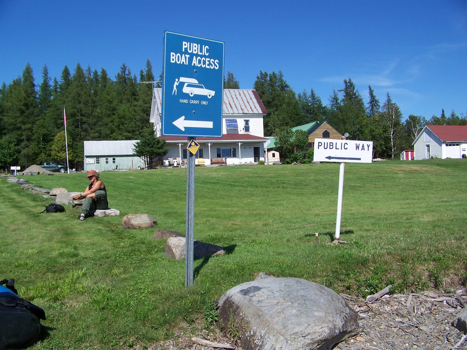
Packed up and headed toward Long Lake Dam. We couldn't immediately see access on the right side where the portage is reported to be, but we could see the horizon line drop. The left seemed to have a obvious trail so we headed over there first to take a look. It didn't lead anywhere, but we now could see the right portage clearly. It's near the dam, but safe enough to paddle and goes through the campsites. After all these days, I still am skeptical about where the portages are where dams are concerned.

The family we saw yesterday continues to be a source of conversation for us. I reflected that these are probably the kind of people who would feed marshmallows to bears. Kay said that maybe some people NEED to be encouraged to feed marshmallows to bears. Touché.

Whipped along to Round Pond, appreciating the elm trees that are scattered from the Blanchet-Maibec bridge to the pond's inlet. I had been looking forward to paddling through "The Shire." Took a break for lunch at the very nice Inlet campsite and were joined by a six paddlers working their way through the Allagash, including the author of the NFCT's Map 13 descriptions. How cool was that?

We heard there was a spring just north of the ranger station on Round Pond. We had missed the one marked with blue ribbons on Umkaka (Umsaskis) Lake yesterday and looked forward to filling up our water bottles without pumping. However, the water coming out of the pipe looked pretty sediment-rich. The water was clearly brown. We moved on.

We are surprised to be noticing all the mowed lawns on the campsites and so many bridges within a "wilderness" area. I don't mind the convenience of the picnic tables, tarp poles and beautiful firepits, but the putting greens seem out of place. We later learned that the mowing is done to help keep the bugs down -- and because people have come to expect this. If nothing else, spotting the manicured campsites is relatively easy. Took another stop at the Croque Brook campsite to pump water and use the outhouse (not at the same time) and it was really buggy. (The site, not the facilities.) Guess the mowing didn't help that site very much.

The elms near Round Pond

The high water is making the rips easy, fun and less tense for the boat and I. Or else I'm continuing to be more comfortable in faster water. There were continuous rips all the way from Round Pond to the Musquacook Deadwater and then again by the Five Finger Brook campsites. Kay sits in front in the "princess" seat and paddles when I tell her. It's a good arrangement.

Stopped at Bass Brook and a small campsite that had room for only one tent. Tonight is the first time Kay and I made a campfire and only the fifth one or so of my trip. I think I've been working my paddling partners too hard?

Tonight is also the coldest one so far.

Dinner: Oat scones and spinach bisque with an added pouch of salmon ladled over black beans and rice. This was one of the best dinners we had. Perhaps we've been living outside for too long now.


Heading toward Long Lake Dam from Harvey Pond


Bass Brook Campsite


Day 50, Aug. 22: Eagle Lake to Harvey Pond

Mileage: 24 miles (not including Chase Rapids)

Weather: Rain showers in the morning, then partly sunny in the afternoon with scattered downpours

Wildlife: Five moose, several eagles, hawk, loon, early-morning low flying geese

Portage: Took the $10 Chase Rapids Shuttle

On the water by 7:10 a.m. after a somewhat restless night's sleep. Kay heard something scurry by her head at one point. A few mosquitoes lazily buzzed me. I found that putting in the ear plugs not only keeps the animals away, but is also good for mosquitoes too. Rained on and off throughout the night. Stopped while we were loading up the canoe, but started again once we were on the water. Of course.

Tail winds picked up as we exited Eagle Lake and gave us an awesome ride all the way to Churchill Dam. We were 10 miles away from the dam and needed to be there before noon if we wanted to take advantage of the water release to ride through Chase Rapids. Based on yesterday's mileage, I assumed we wouldn't make it. But we did the first 9 miles in two hours. And that was without a sail. Kay was the perfect rudder.

We saw two moose within the first hour.

The front was pushing away, the clouds breaking up and chunks of blue sky appeared behind us as we made our way through Round Pond to John's Bridge. Two sets of three or five Canadian geese flew at us just skimming the surface and passing within feet of the bow, the light sandwiching them between the burnished gray water and the steel-wool clouds. We didn't think they saw us. They brushed past us seemingly at eye level. In that moment time slowed. It felt like we were watching an animation. Or a page from The Book of Merlin. It was very surreal. Both of us looked at each other, completely awestruck.

We passed Scofield Point and saw that at least one campsite was occupied. This was the point that I had hoped to reach the day before.

Saw moose #3 in the reedy bay on the northwest as we approached Churchill dam. Apparently this is very common. But typically there is a gang of them instead of only one. Sigh...Talked to two rangers upon our arrival about running Chase Rapids. A very cheap ($10 for all your gear and however many canoes and bodies per party need to be moved) shuttle is offered for avoiding the Class II stretch of water. I had been deliberating about this for some time. Both of the rangers said they wouldn't do it with my type of canoe. So, I took their advice and didn't risk it. I did consider asking a solo paddler if I could ride down with him, but neither of us knew the others skill set (and I was probably highly suspect not wanting to take my own canoe), so Kay and I got our stuff loaded in the truck. And now I'll turn the page over to Kay's observations of the next part of the day.


We pulled up onto the landing at the dam at the north end of Eagle Lake. We walked around the grounds and were met by a ranger (warden?).  Katina asked him if he’d run the rapids (Chase Rapids); he said “yes”.  She asked if he’d do it in a Kevlar boat?  He immediately replied “no”.  OK  Dilemma settle.  For $10, the rangers would shuttle us and our gear past the rapids.  Katina registered us into the Allagash Water Way (4 nights; Shady, the porch (a slight mistruth was told here), and two nights upcoming) and paid for the camping and shuttle.  While she was doing that, various members of a family came into the history museum where we were.  A few of them would be joining us on the shuttle.  Ed, the ranger, went down to the landing to get the families’ boats and gear.  He returned shortly to retrieve a trailer.
 Katina and I browsed through the history museum and walked down to the landing for our ride.
 We arrived below Bissonette Bridge, the shuttle drop-off point.  I looked at the trailer; it was stuffed full of coolers and even held a 20lb propane cylinder.  The back of Ed’s truck contained fishing poles, life jackets, two bags of garbage (compared to our one zip-lock bag of garbage), an ax, foam pads…it almost looked like a garage sale gone wrong back there.  
Katina carried her canoe down while I helped Ed locate and remove our gear.  He asked me to hang around in case some of our stuff was buried. 
We got our gear down to the river and watched the girls bring down pieces of the families stuff.  Then…we saw it…one of their canoes loaded full and high with coolers and who knows what being dragged down the gravel to the river/put in.  Yikes.
The trailer was FULL: I saw only blue and white coolers at first glance.  The group “men” helped load the two canoes onto the trailer that Ed would pull to the waiting area below the falls.  Four female family members got into the backseat of Ed’s truck; an older grandmother type, a “mom” type and two young girls.  They were on a family vacation traveling down the Allagash (actually up, since it runs north).  They’d made the trip before.  It sounded like a beer fest; they had a “90 pack”.  They were a group of eight; four adults and four youths.  They talked about being dry in the rain the night before with their roaring fire and tarps.  Katina asked Ed about a blowdown – “oh yeah it was a real blow down last night…”  They talked about the “professional” canoeists who stayed at the site next to them; who left before 7:30 w/o proving they really were “professional” according to the “mom”.
Katina had to get a picture. 
We left quickly, wanting to get far ahead of “the family”.  They said they were planning to camp at a site called Jalbert.  We made extra effort to be past that site tonight. 

Missing from this picture -
one 20# propane tank and the kitchen sink

I think I now understand why it only costs $10 for the shuttle. It would cost a whole lot more to fish people like this and their gear OUT of the Allagash. We scurried to get on the water before they did, which took us no time at all to do, being professionals and what not...

I was told the water levels were running at spring levels (1700 cfs) the day we put in. (After Hurricane Irene hit a week later, the Allagash was running at 8000 cfs.) We saw another moose in the river a short time after we left the put-in. Stopped for lunch at the first campsite (Meadows) and were joined shortly thereafter by the solo canoeist from New York, Christer. Christer has paddled the Allagash eight or more times and was the camper we had seen at Scofield Point. Running the rips were becoming fun and now I was second-guessing skipping the Chase Rapids. Too late now.

Headed on to Umsaskis Lake or "Umkaka" as we termed it due to the major head and side winds. We had to spend time tacking before turning toward Long Lake. Stopped at the first site (Pine) to take a break. It was very pretty but too close to a road for my taste. Plus we hadn't put enough distance between us and that family--although, if the wind kept up, we were pretty sure they were going to have problems on "Umkaka" lake too. Once on Long Lake, the side wind turned into a tail wind and we made some more progress before getting hit by a quickly passing downpour. 

Stopped again, this time at Sam's campsite, to make popcorn. Christer caught up to us and we told him he could have this site as we had already decided to head another three miles further to keep making up the miles. The tailwind turned into a headwind and we pulled into a dry Lost Popple campsite. (The scattered shower that nailed us apparently didn't get as far north to this campsite.) The site wasn't too great (dark with a lot of down trees), but the outhouse was brand new and we had a dazzling pink sky as the sun set behind us. Later when we were slathering on Ben Gay, we heard sloshing outside our tent and saw moose #5 of the day silhouetted by the shoreline.

Dinner: Corn chowder, cheesy sweet potatoes

Moose sighting along the Allagash

Sunset on Harvey Pond


Day 49, Aug. 21: Chamberlain Lake to Eagle Lake

Goal Distance: 15 - 20 miles
Actual Mileage: 11 miles

Weather: Overcast in the morning, T-storms in the late afternoon and into the evening

Wildlife: Loons, herons, eagle, barred owls, moose footprints

Portages: 1
.75 mile Tramway between Chamberlain and Eagle Lakes
Carried everything in two trips. Path had been improved by an NFCT work crew a week or two before, but was still muddy in places. Easier to carry than to wheel for us.

Shady campsite on Chamberlain Lake was relatively bug-free and dry, so we left the vestibule open all night. Woke up by the rising sun shining through the mosquito netting of our front door. The tent was condensation-free. Drank coffee sitting on the beach boulders watching the sun rise into the cloud cover. Wind created ripples on the water surface that changed from south to north and back again, but remained calm and at times, completely smooth.

Because of that, we decided to head across the lake to check out Lock Dam. Still no sign of any other people as we passed by more empty campsites. Lock Dam is an interesting piece of engineering--the lake is literally draining out. We saw two kayaks by the Ranger cabin, but all the campsites here were empty too.

Lock Dam "drain"

Leftovers from the logging era

We continued on toward the Tramway Carry and finally saw a group of five or six canoes coming from the direction of Allagash Lake/Little Allagash Falls. Near the east point at the end of Chamberlain, but before the last bay, we spotted a red board without any words that we at first thought meant something. This was located on the northeast point just BEFORE the northeast bay of Chamberlain Lake. This IS NOT a marker. The biggest problem for locating the take-out, I think, is the map and the current water levels? The mouth of the bay is illustrated to be wider than we found it to be. A western point (with some several-year old trees) juts out much farther and closer to the eastern one through which you pass. Maybe more of the points were exposed due to the water level. Like Fish Pond, this bay also was choked with lots of reeds/weeds. We did find a channel that heads slightly westward (left) and located the take-out easily from there. Bottom line is that the Tramway Carry is tucked into the northwestern corner of the most northeasterly bay of the lake. 

The carry trail had recently been greatly improved and I just read a blog documenting some of the hard work that went into its maintenance, now that I'm writing a month after I returned. The moose seem to appreciate it too! 

Tramway Mooseway

Perhaps because it was overcast or due to the recent rain, this portage was much buggier than yesterday's Mud Pond Carry. Deer flies and mosquitoes. They seemed to not be bothering Kay as much. Didn't mess around with the softer stuff and instead liberally applied the DEET. 

The Tramway is another interesting piece of logging history and we checked out the trains and other rusting flotsam and jetsam. Even more so when we saw that Eagle Lake. Unlike it's calmer cousin to the south, the water on Eagle Lake was just a-roaring into the put-in. Where did that wind come from in the time it took us to transport our gear? So, we explored some more, ate lunch, took a nap and waited it out. The kayak(ers) we'd seen parked at Lock Dam paddled over to see the trains while we were hanging out. A couple of hours later, it seemed like the wind had died down enough for us to venture out, but just as we left the cove, we heard thunder. Paddled like crazy to Farm Island where there were three very nice campsites. The clouds with the associated thunder seemed to be running parallel behind us. With an abundance of campsites along the way, we decided to keep hop-scotching while keeping an eye on the weather. Headed to Priestly Point, then Pump Handle still staying ahead of the storm. It was a little frustrating to be slowed down by the weather today. The plan was to make up some miles today and the day had started out pretty well on Chamberlain. 

Tramway Engines


With several more hours of daylight left and at least two, if not three more campsite options ahead of us, we decided to stop in at the nearby Eagle Lake Ranger station to see if we could learn about the current forecast in order to determine how much farther we might be able to go today. Were these just fast moving and passing storms like our day on Chesunkook? Bad/good decision. No one was there. And now the thunder and rain WAS fast approaching. There is a second Maine guide cabin adjacent to the Ranger Station, so we turned over the canoe on the beach and headed up to the cabin to wait out the rain under the protection of the porch. The storm was coming from the southwest, behind us, so we couldn't see if it was breaking up. Heated up some water to make some instant soup to warm us up. Then decided to make dinner intending to wait for a break in order to paddle across to the Little Eagle campsite. The break never came. Wave upon wave of thunderstorms continued to roll over us. So...we ended up blowing up the thermorests and sleeping out in the open on the porch that night. Stayed really dry afterall and fell asleep listening to barred owls. Yet another unofficial campsite for Kay.

Dinner: Beef stroganoff, cup-of-soup, triple berry cobbler


Sep 29, 2011

Day 48, Aug. 20: The Infamous Mud Pond Carry

Umbazookus Lake to Shady Campsite on Chamberlain Lake

Mileage: 6 map miles; 4 paddling miles + the 2 mile portage, which we traversed three times (= 6 miles of actual portaging)

Weather: Sunny, pleasant

Wildlife: Bald eagle, loons, beaver, fleeting glimpse of a furry carnivore along the carry (coyote, wolf, lynx, fox?)


Dinner: Tomato-corn soup, skillet bread, pistachio pudding


Up by 6 am. We took a quick walk to the road that connected to the dam site. (Snowmobile trail?) A beaver was out and about in the pool below the dam and slapped its tail when it heard or saw (or smelled?) me. The storms had lasted only for a few hours and we were happy to have been able to set up before the rains hit in force, even if this night is a strong contender for lousiest campsite. Took a compass reading to shoot for on the east shore and left while the fog was still burning off the lake. We were able to keep the southern shore in sight and then followed the east shore up a bit before locating a very nice cairn indicating the portage. My compass reading was off a few degrees. I later learned that T. K. from Team Moxie was responsible for the beautiful masonry.

Umbazookus Road that connected to our campsite

Early morning on Umbazookus Lake

The Mud Pond Carry cairn
on Umbazookus Lake
The portage IS nothing but a small 2' - 3' wide stream/brook/creek. I was under the impression that the stream was only part of the carry, but no, you follow the stream the ENTIRE way. Supposedly a blind man, Jules Thurlotte, made a career of hauling gear on this carry in the early 1800s. Kay works with the visual-impaired and speculated as to what condition he had to have had in order to do this kind of work. In places, there is still evidence of an old "cordoroy" road. True to the reports, it is wet and muddy, although I think it was less so for us for this time of year. Certainly we didn't have the same problems with bugs. 

There are two potential camping spots on either end of the portage. The first out of Umbazookus Lake is located within a dark clearing. There is an old rusty oil barrel and evidence of campers. I can't remember if it was between the lake and the road or after the road, but it wasn't too far away from the lake. The second is located right by Mud Pond where the put-in is. There are some cleared out spaces where a tent could be pitched in a pinch.

We made three trips that took 5 hours. I had Bon Iver's "Skinny Love" looping in my head most of the time--or at least parts of it: 
…my my my, my my my, my, my
I told you to be patient
I told you to be fine
I told you to be balanced
I told you to be kind… 

Our first trip started at 7:20 am and probably was only a 1/3 to 1/2 mile stretch. We crossed the logging road and had continued on to the first major downed tree obstacle before heading back to retrieve our second load. We used the "leap frog" portaging technique, passing up a load before going back to retrieve it, and then passing the next one.

We wore socks. Kay with her Keens and me with my Teva sandals. It helped to prevent chafing and blisters as the mud worked itself under our arches and toes, which we occasionally had to dig out.

The first half of the trail was muddiest heading upstream. At most, I sank up to my calves in mud, but only a few times. Some parts had some semblance of a trail, but often it was easiest to just stay within the stream. My socks filled up with mud. We saw pieces of discarded duct tape and a broken paddle or two. The second half of the portage was comparatively heavenly. It was now downstream on a firmer, gravel bed with clearer, cooler, only ankle-deep water. There remained, however, a few downed trees to maneuver over, under or around.

At the beginning

First half

Mud

Near the end
Returning the mud from our shoes to Mud Pond


Just before getting to the lake, a beaver dam pooled up water that was just about thigh-high and had to be negotiated. I was under the impression that Mud Lake was going to be the most difficult--sinking into thigh-high mud for several yards. However, for us, the lake was completely manageable. We were able to load the canoe and pole ourselves out from the shore into the deeper waters of Mud Pond using a long branch we picked up along the shore.

My ankles felt a little funny and as I stripped of my socks, a bunch of mud fell out. Apparently socks can fill up with mud too. 

All in all, it wasn't nearly as bad as I had imagined.* Parts are comparable to the BWCA portages. The length was excessive in comparison, but I wonder if there isn't a different mindset about portaging in that the expectation is portages should be wheelable. I'm not saying it was easy. It certainly was challenging. This was all I needed to get done today, so I was mentally prepared to tackle it. I found the woods to be beautiful and the fungi were incredible. I found the many pieces of discarded duct tape along the trail and the socks left at either end to be irresponsible. 

* Remember I did this in mid-AUGUST, not May or June! And we had great weather. And only two deer flies before I sprayed down with insect repellent.

Sphagnum moss and ferns in the woods
along the Mud Carry

Fungi


Mud Brook flowing out of Mud Pond turned out to be a surprise. I don't recall hearing or reading about its speed or rapids. It was narrow with exposed rocks. Would have been really fun to run in a small kayak, but we ended up lining the Kevlar canoe for most of it. Seemed like a happy brook and helped clean the mud off from the carry. We were a bit tired to have to walk again after walking all morning, but it didn't take too long to get to Chamberlain Lake. 

Passed up the first few campsites in order to be further along on the big lake. They all were empty. We thought it was getting late, so we stopped at Shady. The lake was absolutely silent. We only saw one motorized boat's wake in the distance. This seems so strange for a Saturday night. Took a leisurely swim and changed into clean clothes before putting up the tent and tarp to dry out from last night's storm and this morning's dew. Made dinner. Took pictures. Looked at the phone--it's ONLY 6:10 p.m. Had some time to do some sketches of Katahdin in the south, the first time I took out any of the art supplies I brought besides beads. Even with today's Mud Carry, or maybe because of it, this has been one of the best days of the trip.


Our view from Shady campsite
on Chamberlain Lake


Day 47, Aug. 19: Penobscot River to Umbazookus Lake

Mileage: 14 miles

Weather: Hot, humid, early afternoon showers followed by scattered t-storms

Wildlife: Loons, eagles, hawk, heron

Portages: 0

Left camp and continued floating down the beautiful Penobscot River as it flattened and widened approaching Chesuncook Lake, passing old logging-era pile-ons near Boom House. We rounded the point nearest the Boom House campsite and headed toward Graveyard Point so that we could stop in Chesnucook Village for rootbeer and fudge at "The Store." The two Carols we had met on Moosehead Lake told us that they attempted to find "The Store" a few years ago, but hadn't. We followed the path from the boat landing at Graveyard Point that eventually led right toward a cluster of cabins and houses. Jack called off the dog when we rang the big Liberty-like bell to let him know he had customers. Like the BWCA  pre-1980's "Rootbeer Lady," he sells homemade rootbeer and fudge and it was a real treat to meet him. I bought four pieces of the fudge (English Toffee, Chocolate and two Maple-Walnut) and immediately devoured three of them.

Chatting with Jack in "The Store"

Ice-cold rootbeer

Jack and his son Johnny make the root beer and fudge. Jack told us that the year round residents number less than 10.  He runs everything with a generator.  He too has a satellite dish and internet. I’m guessing he was in is 80’s and told us about keeping up with his email.
 
As we talked, two men walked up to the house carrying large water containers. There were dressed in uniforms; state of Main Land Conservation or something like that. Wardens. We chatted…told them what we were doing and payed them for our stay at “The Pines” campsite the night before.  $17.12 for the two of us; non-residents. (I thought I was going to be able to take care of all of our Maine State Campsites in Allagash, but the Penobscot is a different district. )

Kay and these state workers got to exchange shop talk about our respective state budgets. Got back on the water around noon and started heading toward Umbazookus Stream. Storm clouds were blowing in behind us, so we headed over to the Longley Stream campsite where we could quickly pitch the tarp over the tarp pole to wait out any rain. LOVE these Maine "amenities." Longley had two nice tent pad areas and a great firepit. We ate lunch and played cards while waiting out two storms.


Here comes the rain again

After the rain -
looking northeast from the Longley Stream campsite

Headed out again in oppressive heat and humidity. Kay's back was giving her some problems today. Stopped at the campsite on Umbazookus Stream East for a break, but I wanted to press on in order to avoid another potential portage (paddling up the north end of Umbazookus Stream after the bridge) the same day as tomorrow's Mud Carry. It also was a Friday night and the camp site had road access and I thought it could be a potential weekend party site. 

Side note: Maine continues to be virtually litter-free, even where there is road access. 

The water was high enough to mostly paddle upstream that last mile connecting to Umbazookus Lake, but there were a few places where we had to get out and drag or track over low spots. The skies were open, but big thunderheads were approaching. We were making good time until we stopped to chat with five guys who were on their way out from Mud Lake and an Allagash Lake loop trip. Had a nice visit about the Mud Carry, but the gathering clouds started towering over us. We both were anxious to head on--they to the Longley Stream site and we on to the site shown on the south east shore of Umbazookus Lake ahead. The guys warned us we that they had cruised over there to check it out, but couldn't locate it. We had to carry over one downed tree and lift over a beaver dam before punching through the open, old Umbazookus dam.


Umbazookus Dam

The thunder was really starting to roll and we hurried along the southern shore looking for the site. The only potential camping area was an older road just north of the dam, but not in the place where we thought the site should be. It was flat enough. Out of six nights so far, Kay has camped at only one official site that we are sure of since she started on her leg with me. Rigged up the tarp among some weak trees and set the tent up in a hurry. The pole is still holding, but I don't want to test it on a big storm. Made a quick dinner. Mosquitos joined us. Got the dishes done and then I wanted to wash off the humidity, sunscreen and DEET before the storm hit. (I know, seems like the storm was threatening us for quite some time.) The weather WAS weird. Storms were rolling around us the entire time, but held off long enough to get settled. I made a mad, naked dash to the sandy shallows enveloped by an orange/grey sky and flashes of lightning and took a quick, exhilarating dip in the clear water. Rain started falling and I jumped back into the tent as the storm finally broke.

Am sure we are the only people on this lake tonight. 

Dinner: Tuna steaks with basmati rice

Making due with a spot for the night on Umbazookus Lake


Day 46, Aug. 18: Penobscot River

Northeast Carry to the Pines Campsite

Mileage: 14 miles paddling

Weather: Sunny, warm, slightly buggy

Wildlife: Eagle, moose, mergansers, heron, snake in the river

Portages: 1
1.9 miles, wheelable along an established road, except for last .5 miles north of Lobster Trip Rd., which had a lot of beaver activity and was water-filled and boggy. We used the (somewhat-pricey-for-the-distance) shuttle instead from Raymonds Country Store, which we had arranged for the night before. In hindsight, we could have portaged without any assistance, being much fresher first thing in the morning, but that last section was pretty wet, so it was nice to be able to drive instead of walk through it. Ed, the owner of the store and our shuttle driver suggested that this put-in may not be maintained in the future and he will need to use the Lobster Trip boat launch instead of Penobscot Farm for shuttles.

This was also one of the more buggier sections of the NFCT to date. The no-see-ums/ankle biters seemed to stay with us even as we started paddling on the river.

Set the phone for 6 a.m. to make sure we were ready for the 7:30 a.m. shuttle. I have no idea where the time goes. I thought we had plenty of time for making skillet bread for breakfast, but just as I'm ready to put the dough in the pan, Ed showed up with his truck. Camp was more or less packed up, so I left the dough in the ziplock bag and Kay and I decided to finish "brunch" at Thoreau Island.


Brunch break


Winds were still blowing strong off of Moosehead--which was great. Kept the bugs away. My ankles were a mess and now showing signs of yesterday's no-see-um feasting.

Since our interrupted breakfast also meant the coffee wasn't ready, we made a stop at his store for real coffee and more hydrocortizone for those bug bites. Ed's wife Linda was there and chatted about the trip.  They were interested in the map – they didn’t know the store was mentioned.


Kay also reports (from her journal):
Ed seems to have a great memory, great stories and runs a tight ship.  (KD: Including wanting to sell us water vs. allowing us to fill our water bottles from his tap and his $25 shuttle fee for a 1.9 mile one way trip.) 
There is no electricity at the store.  The nearest source is more than 30 miles away.  Ed runs a generator 24/7.  They have satellite and internet.  Ed uses and iPad and Linda uses a Nook.  He said she gets up in the morning, downloads a book and his credit card bill goes up.  He said she read 89 books in three months and wore out a switch on the side of her Nook.
 After 8:00 we climbed into his big Chevy truck and headed up the Northeast Carry.  He stopped the truck partway there and we filled our water bottles from a fresh water spring.  The end of the portage is narrow, we are muddy.  Beavers have built a dam which is causing the area to flood. 
He dropped us off, we unloaded our gear, he turned the truck around and there we were at the West Branch Penobscot River.
 The put-in was mud.  Katina handed the gear down, I loaded the boat, got in the stern and she sat in the bow with dry feet. 
The river is deep today, running at 1300cfs.  Linda had checked for us on Ed’s iPad.  It was an easy paddle.  In no time at all we were at Thoreau’s Island.  We stopped, Katina made breakfast (scrambled eggs and scones) and we enjoyed the site and the sun.  We joked about having “shat where Thoreau shat.”

It was a beautiful day. At one point, we just drifted in silence for a while. I took a video, which I later accidentally erased. Stopped at the Big Ragmuff campsites to look at the small waterfall. Back on the river, we came upon our second moose. This time we cared and took some photos. Two previous thru paddlers (Morrigan and Masha) had reported that the Pines was a nice campsite. It was. Beautiful stone steps, a nice swimming hole. So we stopped there even though it was still early. Good thing too, because as we were setting up the tent, the repaired pole snapped again. Same place, just working it's way down. This time we removed the 1" of jagged, ripped aluminum (carefully keeping the shock cord from also getting cut), duct taped around the broken edge and reclamped it. It need only work for six more nights...

Big Ragmuff Falls
Penobscot moose sighting
The Pines campsite and the tent is still standing


Haven't seen anyone except Ed and Linda this morning. They thought we might see people fishing--especially once we hit Big Ragmuff, but we had the river to ourselves. Went swimming. Made dinner. Hung out until the sunset and watched the bats come out. Mosquitos aren't as big of a bother as those little flies, that still swarmed around our heads during daylight. Kay is feeling better about the mileage goals I have set out for us.

Dinner: Tomato sauce and pasta, spice walnut cake

Sep 28, 2011

Day 45, Aug. 17: Moosehead Lake

Mileage: 17.5 miles

Weather: Sunny, mostly cloudless: head and side winds

Wildlife: Eagle, loons, cormorants?

Portages: 0

Got up at 4:30 and was on the water by 5:30 am. Last night the water was completely calm. And it did start out that way this morning--oh, for about 30 minutes or so. Halfway toward Mt. Kineo, started getting rolling waves. Stopped at Hardscrabble Point (which had some beautiful campsites) and waited a while to see what the wind would do. This turned out to be the theme for the day. Paddle. Wait. Paddle. Wait.

We had considered hiking up to Mt. Kineo during our wait, but felt pressed to get Moosehead "done" while we could. One of the nice things about the NFCT trail is all the possible side trips available, such as hiking up Mt. Kineo, but since there was still some concern about getting the goal mileage in this early in Kay's leg, and the wind was now dying down, we headed out, pointed toward Kelly's Wharf.


Paddling toward Kelly's Wharf

As we were paddling, we spotted two kayakers out in more open water and all of us seemed to be headed in the same direction. The wind actually died down and was very calm and we took a snack break at the Kelly Wharf campsite where the two kayakers from Vermont, both named Carol, caught up to us. The water is incredibly clear and the shoreline with it's tumbled stones reminds Kay and I of Lake Superior.


Moosehead Lake
Lake Superior-like stones

Norcross Point break time


The wind started picking up again, so we wanted to be on our way before it got too bad. The wind and waves kicked our butts. Headed into Big Duck Cove looking for the first campsite along the southern shore. The waves were pounding into the shoreline. Found a protected spot after not spotting the campsite, and pulled off the lake. And took a nap. Kay woke me up and we decided the waves were calming down, so we heading off again--this time hopscotching our way toward Norcross Point where we stopped for another break. The last 2.5 to 3 miles were tiring, but we finally got a bit of a tailwind and arrived at the Northeast Carry in late afternoon. (The portage is adjacent to the big white house adjacent to the cabin with a green roof.)

Northeast Carry

Raymond's General Store
- a short distance from the Northeast Carry take-out -

Was planning on continuing on to the Penobscot River with the goal of camping at Thoreau Island and so wheeled the canoe to Raymond's General Store with the intention of scoring a shuttle to the river. We were both pretty beat after our day on the big water. It was probably a good thing that Ed Raymond's wife had the truck in town, and thus was unable to get us to the river that day. Instead of pushing forward, we decided to head back to the public land by the take-out and set up the tent there after I downed two ice-cream bars and bought beer to take back to the camp with us. (Ed didn't want us camping in his backyard.) There is an outhouse by the landing, so that made camping more civilized. At this point, we didn't have too many other options for camping--and the grassy area itself wasn't perfect-- it was near a swampy area. As I was making dinner, one of the owners of a nearby house stopped by to warn us about the no-see-ums and told us to keep the lights off after dark so we wouldn't attract them. (At least no one kicked us out.) We were in bed BEFORE dark. Wind was still blowing north off the lake and the bugs were only a minimally nuisance. I thought. The next day I discovered the ankle-biters had been out in force. My ankles were covered in bites that were pretty itchy over the next few days. 

Dinner: Mushroom Risotta with Cream of Mushroom Soup, beer

Day 44, Aug. 16: Little Brassau Lake to Rockwood, ME

Mileage: 10.5 plus some meandering tacking into headwinds

Weather: Driving rain in the morning, cleared up by afternoon with an awesome sunset

Wildlife: Mink, deer, eagles, loons, geese, ducks, osprey

Portages: 1 (.25 miles?) around Braussau Dam, carried everything
"Beach" area was bigger due to water draw down

Take-out by Braussau Dam

It rained all night. We felt a pop in the middle of the night and thought something had fallen on the tarp--like a big pine cone. The tarp had held up great and I had kept the tent rain fly really taught for shedding water, but apparently I had tightened up the tent too much. One of the aluminum poles broke, an end of a section near the top had ripped along a joint. The tent had stayed up, but was ajar. We have duct tape.

This is the first day that I had to put wet clothes back on. Who doesn't love THAT feeling? Then a decision--to wear or not to wear rain pants. I hadn't put them on yesterday while portaging. Putting them on this morning over my damp pants potentially means two pants will be wet. But no rain pants means I'll be really wet. Packed up under sprinkles and hoped that meant the rain was ending. My body heat was already drying up my pants, so the rain pants went on over them. 

Good thing. It started raining again the minute we got on the water in a "friendly drizzle." Paddled past what seemed to be the actual campsite on an open, grassy point. The site we stayed at last night was definitely better for our tarp tying needs. Watched an osprey dive for fish before heading out on the big water were there was lots of head wind and big waves. Took our time ferrying and tacking and hugging the southern shore. Decided to take shelter on a beach in a cove to wait out the wind where we rigged up the tarp over a fallen tree to keep the rain off and heated up water to make some instant soup and cocoa. We're wet. Watched a mink running among the driftwood to pass the time --- which was about all we could do besides sipping our hot drinks. Apparently neither of us were in the mood to take any pictures as no documentation exists of this wind-imposed "beach break."

Seemed like the wind had died down and set off again after our hour or so. But no. The wind was there to pound us when we rounded the point between the two Brassau lakes. More ferrying into the wind. This was probably the roughest stretch of paddling to date. Headed toward the Poplar Hill for a rest after crossing the widest part of the lake. Betty and her husband were at a boat landing to greet us. Who was Betty? We didn't know, but she was there and said "Hi! I'm Betty!" Ate a power-bar like snack and after our short visit with Betty, we headed southeast toward the dam with an, ahhhh, tailwind. 

Back on the Moose River, we banged our way through a few more rapids before the river broadened, and deepened. Cabins, camps and marina's appeared along both banks. Stopped at the General Store near Rockwood and each ordered the chicken stew and dumplings for $4.99, which we assumed would be in a bowl and tie us over until dinner. It arrived in a dog-dish sized bowl with two ice-cream scoop sized dumplings. Huge! We ate it all. Also couldn't pass up on a raspberry turnover. 

Mt. Kineo seen as we merged from the Moose River

While it had stopped raining, we were still feeling damp and the clouds were still overhead, so we decided to look for a motel or cabin for tonight's accommodations. Paddled right up to the 1940's  or 50's era Rockwood Cabins, across from Mt. Kineo where we got a two-bedroom place with a kitchen, run by Bonnie and Ron, the nicest people. As Bonnie explained: "It isn't the Hyatt, but it is clean." They helped bring our gear up to the cabin, invited us to their group potluck dinner and Ron even fixed our broken tent pole. 

It's suppose to be nice tomorrow, but am setting the alarm for 4:30 to get an early start on the big waters of Moosehead Lake.

Rockwood Cabins

Moosehead Lake


Dinner: Not too much after our chicken stew "snack." Did have a few appetizers at the potluck tonight. And a beer. Those people at the Rockwood Cabins are so nice!

Day 43, Aug. 15: Long Pond to Little Braussau Lake

Mileage: 9.5 miles (including 3 mile portage)

Weather: Predicted all day rain didn't start until around noon

Wildlife: Bald eagle intent on getting a baby merganser, kingfishers, herons, a group of eight or more loons

Portages: (1)
3 mile Demo Road: Wheelable for all but the .3 mile section at the end through the woods to Little Braussau Lake. We followed the updated, detailed instructions that corrects the errors on the map, even though we screwed up at the end.


It had rained overnight. The forecast was for an all day rain, but we thought it might have been off. Woke up early and got packed up staying dry under overcast skies. The eastern outlet of Long Pond is pretty -- studded with rocky points and islands -- unlike it's western, reedier inlet (which is pretty in a different way.)

The Moose River was low, but we were able to run all, but the last rip (rapid), which was too bony when we scouted it. Were entertained watching an eagle make several passes over a group of mergansers--not certain of whom we were rooting for more. We could see the railroad track parallel the river, but don't recall hearing or seeing any trains yesterday or today.

The painted gauge on the boulder by the take-out was obvious--and obvious that the river was very low --- WAY under 1'. A little higher would have been nice, but I'm not complaining. Still navigational compared to the Nulhegan and S. Branch of the Dead River.


Gauge rock


Had printed out the corrected instructions from the NFCT Trail Update section. It's CRITICAL until the maps are reprinted to know this. The portage route shown on the map (first version) is wrong. Once on the road, we rigged up a pretty good system of tying the front painter rope to the food barrel I was carrying (threading it through the handles on each side) so that the canoe could be wheeled using my shoulders and core vs. pulling it with one arm. Kacia and I had just kept switching sides on the Spencer Rips Road trek when one arm got tired. This system was less tiring--or would have been...

Getting ready for the long haul

About .75 miles into the walk, a retired couple approached in a pick-up truck. With a canoe rack. They stopped to ask where we were going. Charlie had seen two canoeists portaging this section last year and had wondered then, what was up. Even though the new portaging system was working out well, we still accepted a ride from them to get off Demo Road. 

Trail Angels: Charlie and Sally and
their canoe-racked truck

Side note: The scariest thing(s) were the big logging trucks. Two came roaring down the roads, slowing down as they saw us, but still. The road's not that wide. The updated directions I had downloaded were very detailed and we were having no problems following them along the road. The only instances where I felt any fear was wheeling along roads--highways with no shoulders and now logging roads that are clearly being used for exactly that purpose. 

Charlie and Sally gave us a ride to the NFCT-marked logging trail turn off of Demo Road, saving us 1.5  - 2 miles walking along the gravel road. They had a Maine Gazetteer that detailed all the logging roads. It might be a good idea for the NFCT maps to include the logging road numbers as part of the portage instructions. Our local trail angels, both Charlie and Sally and the fishermen who helped out Kacia and I, referenced and knew the logging road numbers--almost more than the names of the roads. 

Kay and I took the first two gear bags and started walking. And walking. And walking. It started raining. Apparently with our heads down and covered by hoods, both of us missed the NFCT blaze that indicated the .3 mile path through the woods. I'm going to sound completely clueless now when I write to say that we kept continuing from an obviously cleaned up trail (brush had been nicely removed) on to an increasingly narrowing and overgrown trail. The instructions say that the last leg through the woods is rough. So, yeah...this trail was becoming rougher. And it still cut through a woods. When the trail appeared to turn into a moose trail, but still uncertain if we were in error, we dumped the bags (just in case we were right), retraced our steps to bring the canoe and third bag up to at least another halfway point, and -- voila! There was the blaze right where the brush clearing had ended. To the NFCT's credit, the trail HAD been well-marked up until the point we started ignoring the obvious signs. (There are also blue/yellow painted blazes along this and the Spencer Rips Road. Seem to be suggestive of following the NFCT trail, but I haven't seen any literature that says these were painted/planted by the NFCT.) Still, there were there along this section and had disappeared when we kept bushwacking our way away from the portage.

Ultimately we saved no time or distance by getting a ride. We are sure we walked even farther! (Karma bites...) Brought the canoe to the TURN OFF (it's on the right), through the rough, but marked woods trail (a dark trek) to Little Brassau Lake, then headed back to pick up the first two bags we had left farther up the non-trail. To pass the time, I counted steps again, something I hadn't done since the first week along the road from Forked Lake to the Raquette River in the Adirondacks. Counted 1,150 steps. Or about a half of a mile. One way. By the time we got everything to the Little Brassau Lake put-in, we were completely soaked. 

Little Brassau put-in back on the Moose River

Getting dry again

Took the first site we saw only a short distance from the put-in. Not sure if it was an official site, it didn't seem to be on the right point on the map, but clearly it had been used as a site-- and there was a firepit. The tell-tale green and red blazed rocks told us other canoes had pulled up here too. Water was REALLY low here--those blazed rocks were out quite far from the site itself. Set up the tarp first, then the tent and got into dry clothes. Made some instant pea soup (thanks Sara for that last minute gift!) which helped warm us up. Read for a while, then made dinner and enjoyed the dinner show of a large group of socializing loons. Still raining, but we're staying dry.

Dinner: Lentil noodle soup (pretty heavy and needed more of something--like flavor.)