Trip Date: May 25, 2019
Miles: About 12.5 (out of 17 miles) in 4.5 hours including the shuttle along the way and a lunch break
Portages: 1 (4.5 miles by car bypassing the Mollidgewock rapids)
Paddling Partner: Laurie Chandler
Boat: Wenonah Minnesota II
Weather: Sunny and pleasant
Overnight: Stark Village Inn
Overview
Sam assisted us with our shuttling today, but while Laurie and I were on the water, he spent his time on the golf course he had noticed the day before during my antibiotic run to Colebrook. Both Laurie and I had scouted the rapids between Mollidgewock and Seven Islands Bridge on our drives en route to Errol and with the high water, neither of us were interested in tempting fate in my tandem open expedition canoe. We staged her car at Mollidgewock State Park which we would then use to shuttle the ourselves and the canoe to a wayside at Seven Bridges thus avoiding the most turbulent waters. Sam would then meet up with us later in the day at the take-out at Pontook Dam.
We parked Laurie's car near the park office, at a point where a small group of kayakers were getting set to launch. Just as we were about to leave, a man from the party rushed toward us. He had accidentally left his paddle in their shuttle vehicle downstream. While Sam took him back to retrieve it, Laurie and I visited with the group. Turns out it was an AMC outing led by Loretta Brady, an extremely active member of the NY-NoJ Chapter of the Appalachian Mountain Club's Canoe Kayak Committee. She was interest in hearing about both Laurie's memoir
"Upwards" and my
NFCT Thru-Paddler's Companion. And then she kindly wrote up an article about us in the August 2019 edition of the AMC publication
Paddle Splashes.
After the AMC group was off, Sam brought us back to Errol. Laurie and I signed in at the NFCT kiosk and then launched below the Route 26 bridge. Even though we've known each other a few years--mostly via Facebook and email--this is the first time we've paddled together. We used my Minnesota II today, but tomorrow I'll borrow a rec kayak and she'll paddle her own kevlar boat for our trip down the Upper Ammo.
Seemed as if only a few minutes had passed and we were back at Mollidgewock strapping the canoe atop Laurie's car and off to put back in at Seven Islands Bridge, a little less than five miles downstream. The rest afternoon was spent flatwater paddling with only one little run through some rapids at the southern end of Thirteen Mile Woods. Could our continuous conversation be the reason we failed to see any wildlife?
Sam met us around 3:30 and took Laurie back to retrieve her car, then the three of us headed to Stark for the first of two nights booked at the Stark Village Inn.
 |
| Adding greetings to 2019 thru-paddlers at the Errol sign-in box. |
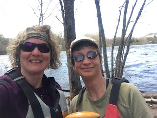 |
| Selfie after Sam left to golf without taking a pic. |
 |
| High water at the Route 26 put-in at Errol. |
 |
| The Andro is so much more pleasant paddling downstream! |
 |
| Looking upstream at Seven Islands Bridge from flooded shoreline. |
 |
| And downstream. |
 |
| Andro flatwater. |
 |
| Pontook Dam take-out (or put-in for thru-paddlers). |
 |
| Pontook Dam in May 2019 |


